Showing posts with label site plan. Show all posts
Showing posts with label site plan. Show all posts
Thursday, May 23, 2013
Building Permit Application: Submitted!
Earlier today we were told that the site plan mylars are at the Town Hall awaiting the final signature from the Planning Board Chairman. The Board and the Town Attorney are still working on the drainage easement language, but the hope is that the Chairman will sign the mylars to let us get our driveway and building permits now. Knowing this, our surveyor suggested that we could probably go ahead and submit our driveway permit applications to the DOT and building permit application to the town - so, we did, along with final stamped engineering drawings and the rescheck (which were just dropped off to us today). Everything is finally coming together! (And seemingly all at once, serendipitously.) Now we just have to wait for approval before we start building - and thankfully, this time we only need one person's go ahead!

Friday, May 17, 2013
Site plan approval, still continued...
After last week's promising update regarding the site plan, we were hoping that enough progress would be made in a week that we might just be able to get our building permit. Unfortunately we were being overly optimistic, but Matt met with the building inspector during his office hours yesterday nonetheless to give him a copy of our house plans so that he could be familiar with them when the time comes for us to apply for a building permit. It turns out that our engineer neglected to do something called a "Rescheck", which is required to get a permit, so it's just as well that we couldn't apply yet anyways. Yet another road block, but at least this sounds like a pretty small one that can be resolved pretty quickly.
So what's the hold up? At this point, our surveyor had the mylars of the site plan signed by the MCDOH and dropped off at the MCDOT. They should sign them on Monday, after which they have to go to the Town Engineer and then back to the Town Hall. The only unresolved issue is the drainage easement. Apparently the Town Attorney is still revising their standard easement wording, and has asked if we could wait until May 22nd or so to add the new language to the description. Then once the town planning board chairman signs the mylars, the surveyor will have to pick them back up and have prints made to distribute to all of the agencies. THEN we can get our driveway permits and the building permit. Slowly, we're getting there... We really would have liked to have been further along by now, but what can you do?
So what's the hold up? At this point, our surveyor had the mylars of the site plan signed by the MCDOH and dropped off at the MCDOT. They should sign them on Monday, after which they have to go to the Town Engineer and then back to the Town Hall. The only unresolved issue is the drainage easement. Apparently the Town Attorney is still revising their standard easement wording, and has asked if we could wait until May 22nd or so to add the new language to the description. Then once the town planning board chairman signs the mylars, the surveyor will have to pick them back up and have prints made to distribute to all of the agencies. THEN we can get our driveway permits and the building permit. Slowly, we're getting there... We really would have liked to have been further along by now, but what can you do?
Wednesday, May 8, 2013
So tired, tired of waiting...
Today we got an update on the status of our site plan! The plans have been approved by the Department of Health, and the Department of Transportation should be finished with their review by the end of this week. Our surveyor has finished his updates to the site plan and has drafted up an easement agreement with the town which has been dropped off at the Town Hall. It looks like we are finally making some progress... It has been 7 weeks since the Town Planning Board meeting when we were given conditional approval. Could it be that a building permit is finally on the horizon?? With springtime weather having finally arrived for a good stretch, it seems like a promising time to get started, which we are very anxious to do. All this paperwork has really been holding us up.
Wednesday, March 20, 2013
Site Plan Hearing
Last night our site plan went before the Town Planning Board for approval. Prior to tonight, a couple committees as well as the town engineer reviewed the plan and made comments. Those were then reviewed by the Board in an open forum. It was very interesting to witness this process, which took some time but was very exciting for us nonetheless. Overall the review of our plan was relatively uncomplicated, but there were a few notes requiring discussion:
Overall, the meeting was very interesting, and it was very nice to meet the gentlemen who sit on the board. They were very friendly and welcoming, and actually seemed rather excited about our little project. In fact, one member of the board also has geothermal, and was very excited to tell us how great it is - and it turns out, his was also installed by Roth Green Energy! He is very happy with it, which is reassuring for us (not that we had any doubts). All in all, an encouraging and exciting meeting - we can't wait to get moving! But for right now, we still have to...
Updated budget:
+$125.00 - Rush Planning Board Site Plan Hearing Fee
+$300.00 - Monroe County Department of Health site plan review fee
+$50.00 - Monroe County Highway Department site plan review fee
+$3,265.00 - Balance to surveyor
TOTAL SPENT SO FAR: $36,328.29
- The fire district recommend a sprinkler system because of distance from road and lack of water source. After some discussion we decided this was unnecessary.
- Requirement of drainage easement means and bounds map because of stream on property
- Do we need a description of corridor or a detailed survey?
- A detailed survey would be exceedingly difficult (and expensive and inaccurate) because it is a meandering creek
- Description would be good enough.
- The Conservation Board asked, "Will it be a modular house?" - and no one knows why.
- The Conservation Board also noted that the "sensitive areas" (farms, etc) listing was missing, while in fact it was included and for some reason they just overlooked it - and again no one knows why.
- Steep slopes need approximate labeling on the plan.
- Must edit note about visibility from driveway to agree with Dept. of Transportation assessment.
Besides all of that, the Board found no issue with our plan. So after our discussion they moved on to what was next on the agenda, and we had to wait until the end of the meeting to get our ruling. All in all:
- No futher environmental review
- Must make updates to comply with town engineer comments (need easement language, steep slope labeling, etc.)
- Must also comply with Monroe County Department of Planning & Development comments, when received
Overall, the meeting was very interesting, and it was very nice to meet the gentlemen who sit on the board. They were very friendly and welcoming, and actually seemed rather excited about our little project. In fact, one member of the board also has geothermal, and was very excited to tell us how great it is - and it turns out, his was also installed by Roth Green Energy! He is very happy with it, which is reassuring for us (not that we had any doubts). All in all, an encouraging and exciting meeting - we can't wait to get moving! But for right now, we still have to...
Updated budget:
+$125.00 - Rush Planning Board Site Plan Hearing Fee
+$300.00 - Monroe County Department of Health site plan review fee
+$50.00 - Monroe County Highway Department site plan review fee
+$3,265.00 - Balance to surveyor
TOTAL SPENT SO FAR: $36,328.29
Thursday, December 13, 2012
Perc Tests, Take 2
Nearly 10 days ago we had our first perc tests and DOH inspection of the site. Unfortunately at that time, the standard perc tests failed. We did determine a location further away from where the house is planned that appeared suitable, but more perc tests were going to have to take place, again with a DOH representative present. This time we would not need to do the deep hole investigation, though, since that was accepted previously.
Earlier today our surveyor came back with the DOH inspector to witness perc tests at the new septic site. These tests were modified so as to be 12" deep and 18" deep holes instead of the standard 24". And the good news is, the 18" holes passed within 45 minutes! So taking these results into account, we now have a vague idea of what the septic leach field will have to be.
The Monroe County Dept. of Health website includes a helpful downloadable Sewage Disposal Design Handbook, which I have perused in an attempt to understand what kind of system we require. It turns out that there are many more options than I realized, and while the information is rather straightforward to follow, this goes outside my range of knowledge. From what I've read, and using the results of the perc tests, I believe we will be installing a modified raised bed system. We will need about 6" of sand to make up for the lack of depth of acceptable ground soil, but luckily this is on the rather low end of things as far as raised beds go. We will know more once the full official site plan is drawn up, which will take about 6 more weeks. Once the surveyor has completed his design, we can take it to a septic installer to get construction under way, during/after which we'll need more inspections. In the short term, now that we know where the septic system will go, we can get a well installed!

Updated budget:
Another Fee to Monroe County Dept. of Health: $125
Surveyor Fee: estimated to be ~ $5,000 total (standard); $1,500 down payment made.
Total spent thus far: $1,810
Earlier today our surveyor came back with the DOH inspector to witness perc tests at the new septic site. These tests were modified so as to be 12" deep and 18" deep holes instead of the standard 24". And the good news is, the 18" holes passed within 45 minutes! So taking these results into account, we now have a vague idea of what the septic leach field will have to be.
The Monroe County Dept. of Health website includes a helpful downloadable Sewage Disposal Design Handbook, which I have perused in an attempt to understand what kind of system we require. It turns out that there are many more options than I realized, and while the information is rather straightforward to follow, this goes outside my range of knowledge. From what I've read, and using the results of the perc tests, I believe we will be installing a modified raised bed system. We will need about 6" of sand to make up for the lack of depth of acceptable ground soil, but luckily this is on the rather low end of things as far as raised beds go. We will know more once the full official site plan is drawn up, which will take about 6 more weeks. Once the surveyor has completed his design, we can take it to a septic installer to get construction under way, during/after which we'll need more inspections. In the short term, now that we know where the septic system will go, we can get a well installed!

Updated budget:
Another Fee to Monroe County Dept. of Health: $125
Surveyor Fee: estimated to be ~ $5,000 total (standard); $1,500 down payment made.
Total spent thus far: $1,810
Tuesday, December 4, 2012
The Percs of House Building
Last week some official initial site planning took place. A surveyor and my dad dug some deep holes for perc tests. I guess the process is to dig holes, pour in water, and time out how long it takes to drain. According to Wikipedia:
Prior to today, a few stars aligned. A neighbor who runs a deer farm visited my parents a couple weeks ago because a bunch of the deer got loose, and they were wondering whether my parents had seen any. My dad agreed to keep an eye out... and meanwhile, it turns out this neighbor has a backhoe/bulldozer, and is willing to help out with digging. Fantastic coincidence!
Today, the surveyor, the inspector, the neighbor, my dad, and Matt and I all met in the field to dig trenches and analyze the dirt profile. Water was poured into the perc holes again for the inspector to observe and time.
And then our friendly neighbor started digging!


 After digging about 4 feet, the inspector hopped in.
 He picked away at the walls, crumbled the dirt in his hands, and measured how deep any mineral deposits were. Apparently minerals started appearing at about 19", which indicated the presence of water. The septic leach field needs to be a certain amount above the water table (I think 2'), so we would not be able to do a conventional below-surface design. Instead, we would have to do a modified raised system, which would be more expensive. Basically we would need sand, gravel, and topsoil to make up the depth difference - assuming the perc tests would pass within 45 minutes. However, it didn't look like that was going to happen. After digging down two more feet to make sure the analysis of this ditch was exhausted, the hole was backfilled and we scoped out another spot which might be more suitable.
As opposed to the initial dig, which was slightly downhill and west of the proposed house site, the surveyor suggested trying to dig east of the house where the land also sloped away, albeit more gently. And so, ditch #2 was dug.


This time, mineral deposits showed up at only 8" - even worse. We gave this ditch its due diligence and still dug down the full 6 feet before backfilling, but it was clear this site was not going to work. And after checking the perc tests, it became clear that in order to use the initial site, we would need an even deeper raised bed system - which would be even more expensive.
After the initial surprise and panic subsided, brainstorming ensued. So long as we were 100' away from any neighbors or streams (no problem), we could have the leach bed farther from the planned house site. We went back to the west side, further down the hill, and dug a third hole.
 This dirt was rockier, but - success! The mineral deposits were 24" down this time. While we will likely still need to do a modified raised bed system (considering the slow perc tests), to install it further down the hill would mean trucking in less sand and topsoil. So it's looking like this will be the site.
Unfortunately, we would need new holes dug for perc tests to determine the necessary depth/height of the system, which would take more time than the surveyor had for today. We will have to wait until next week to get new perc tests done, and then have the inspector come out again and basically repeat the whole process we went through today - but hopefully next time we'll actually end up with an approved site.
Once we know where the septic is going to go, we can get a well drilled and house plans drawn up while the surveyor develops the detailed site plan. Although today did not totally go as planned, we have the time to be flexible and still keep on our rough timeline. Besides, it was fun getting out to the site and digging some holes - this is getting real! The not-so-fun real part was that today we incurred our first costs.
Gratuity to neighbor for use of his backhoe/bulldozer (initially he politely refused, but we wanted him to walk away with something): $60
Fee to Monroe County Dept. of Health: $125
Surveyor Fee: TBD with contract
Total spent thus far: $185
The goal of percolation testing is to ensure the soil is permeable enough for septic tank effluent to percolate away from the drain field, but fine grained enough to filter out pathogenic bacteria and viruses before they travel far enough to reach a water well or surface water supply. Coarse soils – sand and gravel – can transmit wastewater away from the drain field before pathogens are destroyed. Silt and clay effectively filter out pathogens but allow very limited wastewater flow rates. Percolation tests measure the rate at which clean water disperses through a disposal trench into the soil.Apparently the results weren't ideal, but either way we were going to need to dig some deep trenches and have a Monroe County official come out and inspect the dirt, which was scheduled for today.
Prior to today, a few stars aligned. A neighbor who runs a deer farm visited my parents a couple weeks ago because a bunch of the deer got loose, and they were wondering whether my parents had seen any. My dad agreed to keep an eye out... and meanwhile, it turns out this neighbor has a backhoe/bulldozer, and is willing to help out with digging. Fantastic coincidence!
Today, the surveyor, the inspector, the neighbor, my dad, and Matt and I all met in the field to dig trenches and analyze the dirt profile. Water was poured into the perc holes again for the inspector to observe and time.
 |
| Perc test site 3 of 3 |


 |
| Soil profile in the first ditch. The orange stripe is the mineral deposits. The soil was rather sandy, with enough clay to be able to mold a ball. |


This time, mineral deposits showed up at only 8" - even worse. We gave this ditch its due diligence and still dug down the full 6 feet before backfilling, but it was clear this site was not going to work. And after checking the perc tests, it became clear that in order to use the initial site, we would need an even deeper raised bed system - which would be even more expensive.
After the initial surprise and panic subsided, brainstorming ensued. So long as we were 100' away from any neighbors or streams (no problem), we could have the leach bed farther from the planned house site. We went back to the west side, further down the hill, and dug a third hole.

Unfortunately, we would need new holes dug for perc tests to determine the necessary depth/height of the system, which would take more time than the surveyor had for today. We will have to wait until next week to get new perc tests done, and then have the inspector come out again and basically repeat the whole process we went through today - but hopefully next time we'll actually end up with an approved site.
Once we know where the septic is going to go, we can get a well drilled and house plans drawn up while the surveyor develops the detailed site plan. Although today did not totally go as planned, we have the time to be flexible and still keep on our rough timeline. Besides, it was fun getting out to the site and digging some holes - this is getting real! The not-so-fun real part was that today we incurred our first costs.
Gratuity to neighbor for use of his backhoe/bulldozer (initially he politely refused, but we wanted him to walk away with something): $60
Fee to Monroe County Dept. of Health: $125
Surveyor Fee: TBD with contract
Total spent thus far: $185
Sunday, October 21, 2012
Preliminary Site Planning
My dad (whom I introduced you to in one of my first posts), being retired and all, is fortunate to have a lot of time to think about Futurehome. Because of this he has taken on somewhat of a project manager role. To that end, he stopped by the town hall a while ago to pick up some information on forms and permits that we will eventually have to complete, to help us get a sense of what to expect. From this it became clear that one of our first tasks will be to hire a surveyor to come out, analyze the land, and develop a site plan. Well, we figured we could help this along by doing a little site planning of our own, using what we know about general well and leach field requirements and our initial house design. Then, it should hopefully be a quick and painless process to have the surveyor come out.
Conveniently enough, there is a USGS benchmark on the property:
Unfortunately, it is a little mangled. Nonetheless, we used this as a control point with our little handheld GPS. First we measured the two nearest utility poles relative to the BM, as well as the distance to the current driveway.
We were originally estimating that Futurehome should be about 300' north of the BM, so we trudged into the field due north. However, this actually put us into a totally different part of the land than we were expecting, and we were a ways down the hill that we were planning to be on the crest of. It turns out that none of our visual cues from the ground were straight or lined up latitudinal or longitudinally - the road, the tree edge, the hill, nothing. So it was a good thing we were using a GPS for a guide. It was surprising to realize how disorienting the whole area was. Using a compass we headed due east to the crest of the hill for what turned out to be ~150', and marked that point on our GPS and in the ground with a stake as the south west corner of Futurehome.
From there we used a tape measure to go 32' north and mark the NW corner; then 64' east to mark the NE corner; and then 32' south again to mark the SE corner. From the NE corner we paced about 30' east and 20' north for an approximate well location. Now with an idea of where the house will most likely go, we had a chance to look around and get a feel for it all. We took a bunch of pictures all around us and used Photosynth to generate a 360º panorama of the current view. A keen eye will be able to spot my dad hidden in among the gone-to-seed goldenrod, and an even keener eye will be able to spot the car we used to drive in. Obviously the vegetation is quite tall, so we will probably go in with a tractor mower soon to clear away at least the house footprint.
The existing driveway ended up being mostly straight ahead but with a couple trees in the way, which blocks the view of the house from the road (all good things, in our opinion). The house is practically smack-dab in the middle of the field, with the woods and valley not too far behind. And as you can see from the Photsynth, there is not a neighbor in sight.
Using a level set to a measured angle, we were able to estimate where the sun will cross the sky in the winter and summer months, and confirmed that the house is far enough away from the tree line to get full southward facing sun year-round. All things seemed to be coming together quite nicely, so we decided we were very happy with the site we staked out.
Using our waypoints and measurements, we drew up a nice little preliminary site plan:

Hopefully we will be able to use all of this to smoothly get an official site plan drawn up, and then we can really get the ball rolling on things like making a driveway, drilling a well, etc. Either way, this was a very exciting visit to the site of Futurehome.
Conveniently enough, there is a USGS benchmark on the property:
 |
| Whoever does the mowing along the road apparently is unaware of the fine or imprisonment associated with disturbing benchmarks. |
We were originally estimating that Futurehome should be about 300' north of the BM, so we trudged into the field due north. However, this actually put us into a totally different part of the land than we were expecting, and we were a ways down the hill that we were planning to be on the crest of. It turns out that none of our visual cues from the ground were straight or lined up latitudinal or longitudinally - the road, the tree edge, the hill, nothing. So it was a good thing we were using a GPS for a guide. It was surprising to realize how disorienting the whole area was. Using a compass we headed due east to the crest of the hill for what turned out to be ~150', and marked that point on our GPS and in the ground with a stake as the south west corner of Futurehome.
From there we used a tape measure to go 32' north and mark the NW corner; then 64' east to mark the NE corner; and then 32' south again to mark the SE corner. From the NE corner we paced about 30' east and 20' north for an approximate well location. Now with an idea of where the house will most likely go, we had a chance to look around and get a feel for it all. We took a bunch of pictures all around us and used Photosynth to generate a 360º panorama of the current view. A keen eye will be able to spot my dad hidden in among the gone-to-seed goldenrod, and an even keener eye will be able to spot the car we used to drive in. Obviously the vegetation is quite tall, so we will probably go in with a tractor mower soon to clear away at least the house footprint.
The existing driveway ended up being mostly straight ahead but with a couple trees in the way, which blocks the view of the house from the road (all good things, in our opinion). The house is practically smack-dab in the middle of the field, with the woods and valley not too far behind. And as you can see from the Photsynth, there is not a neighbor in sight.
 |
| The current "driveway"...kinda |
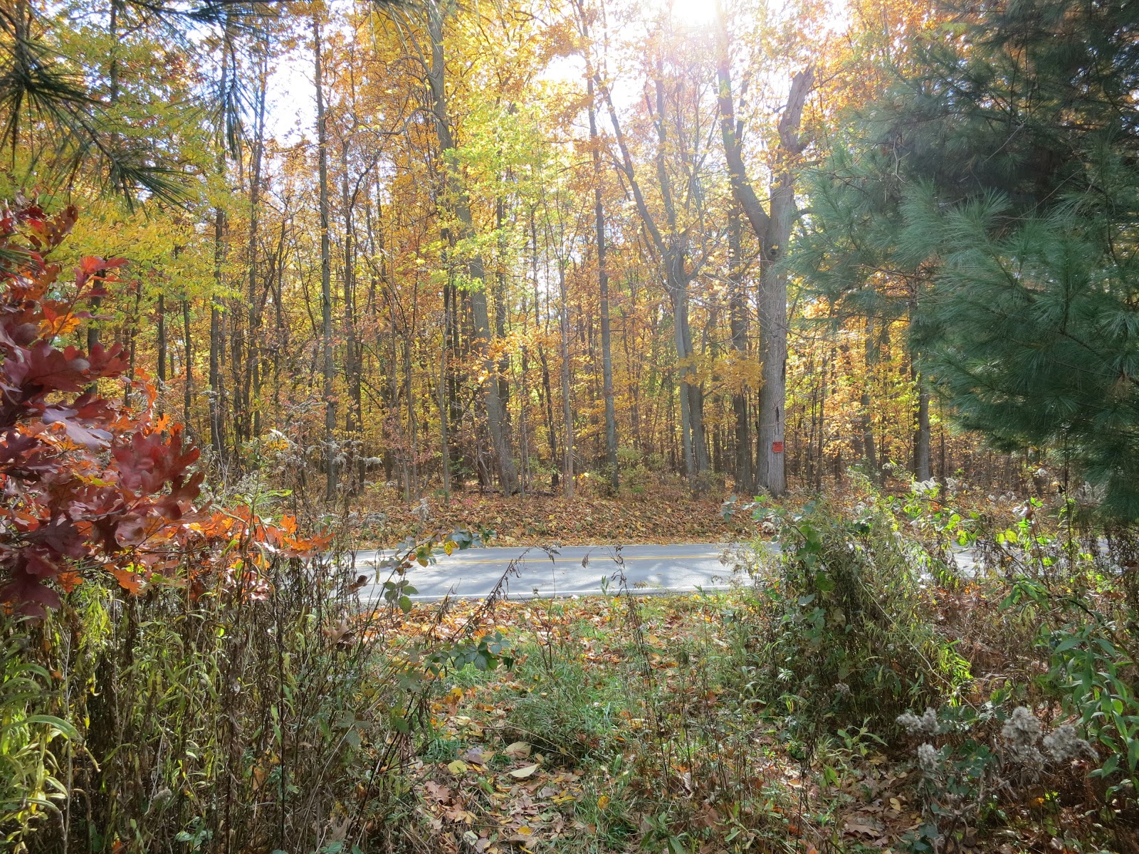 |
| The view exiting our property at the planned driveway location. I really hope construction equipment can fit through here without having to take out trees, because this is a beautiful sight. |
 |
| (I'm keeping all exact locations private for now, hence the smudges.) |
Hopefully we will be able to use all of this to smoothly get an official site plan drawn up, and then we can really get the ball rolling on things like making a driveway, drilling a well, etc. Either way, this was a very exciting visit to the site of Futurehome.
Subscribe to:
Posts (Atom)